Maps:

Japan Political Map - Free World Maps
|

Ecuador Political Map - World Map
|

Japan Physical Map - Japan Maps
|
Ecuador Physical Map - Free World Maps
|

Japan Choropleth Map - Flood Map
|

Ecuador Isoline Map - UT Library
|

Japan Cartogram - World Mapper
|
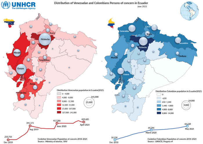
Ecuador Dot Distribution - UNHCR
|
Four Level Analysis:
Level Three:
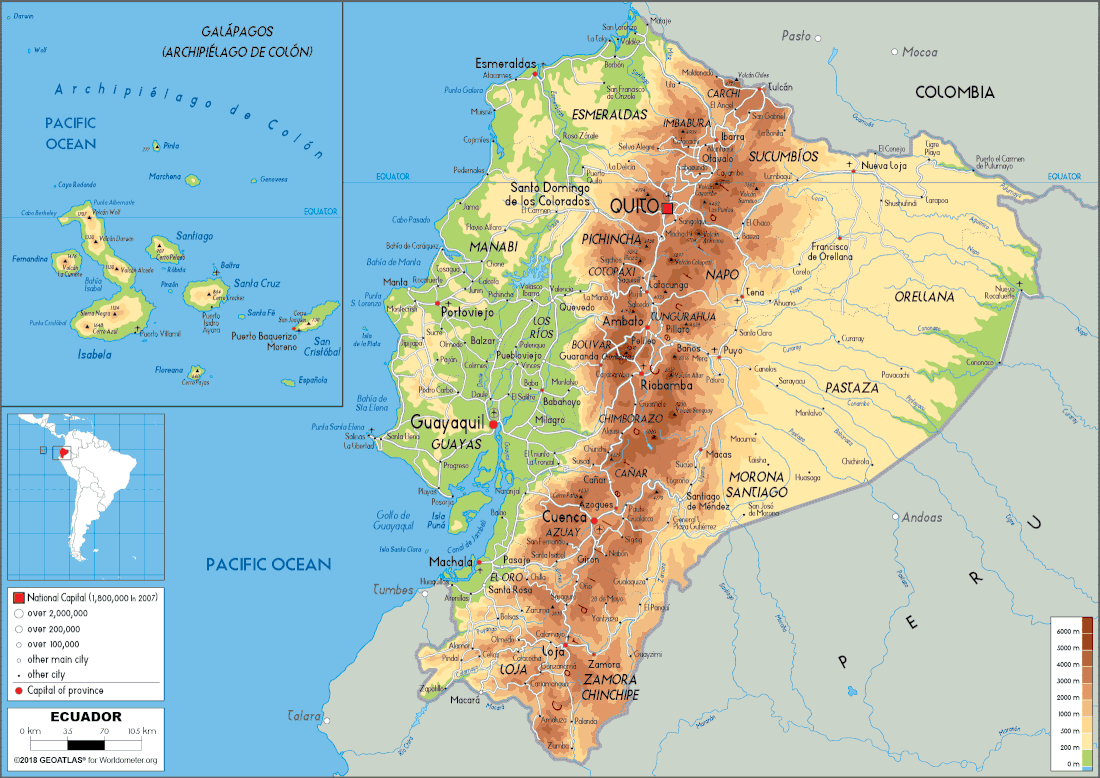
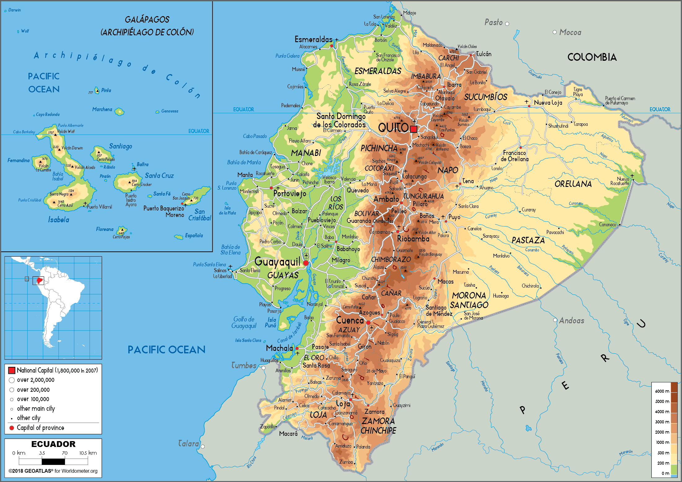
The North and South borders of Ecuador are on the mountain range because they split the range. There is a greater population on the coast because there is a lower elevation, so it is easier to access from the coast. So, more people live on the coast. There are some very large cities such as Guayaquil on the coast because of access to water for import and export. There are also some large cities such as Quito that are located in the Andes mountains of Ecuador because they are historically important. There are less cities in the Eastern part of Ecuador because there is the Amazon that takes up most of that area. |
Level One:
Map of Ecuador, National scale, physical map, different colors represent elevation, shows cities and Capital. Level Two: The Andes mountain range and a higher elevation is present down the middle of Ecuador. There low a elevation on the coastal region by the Pacific Ocean. On the East side of the Andes, there is an Amazonia area with a lower elevation, but not as low as on the coast. Many rivers running throughout the country. The Andes mountain range is labeled as "Cordillera Central" running vertically through the country. The equator intersects Ecuador close to the top of the country. More cities on the West of the Andes than the East Level Four: These assets provide support for the residents because there is a thriving community of people in West Ecuador. The distribution of people in Ecuador leads to strong coastal cities and important cities in the mountains. In the future, there will be an increase in population in the Eastern and middle parts of Ecuador. This will be due to people moving away from the ever growing population in the coastal cities of Ecuador. There will be an expanse of population over the coast as more coastal centers. However, the main city of growth will be Guayaquil because it is the most important city in Ecuador's economy. |
